


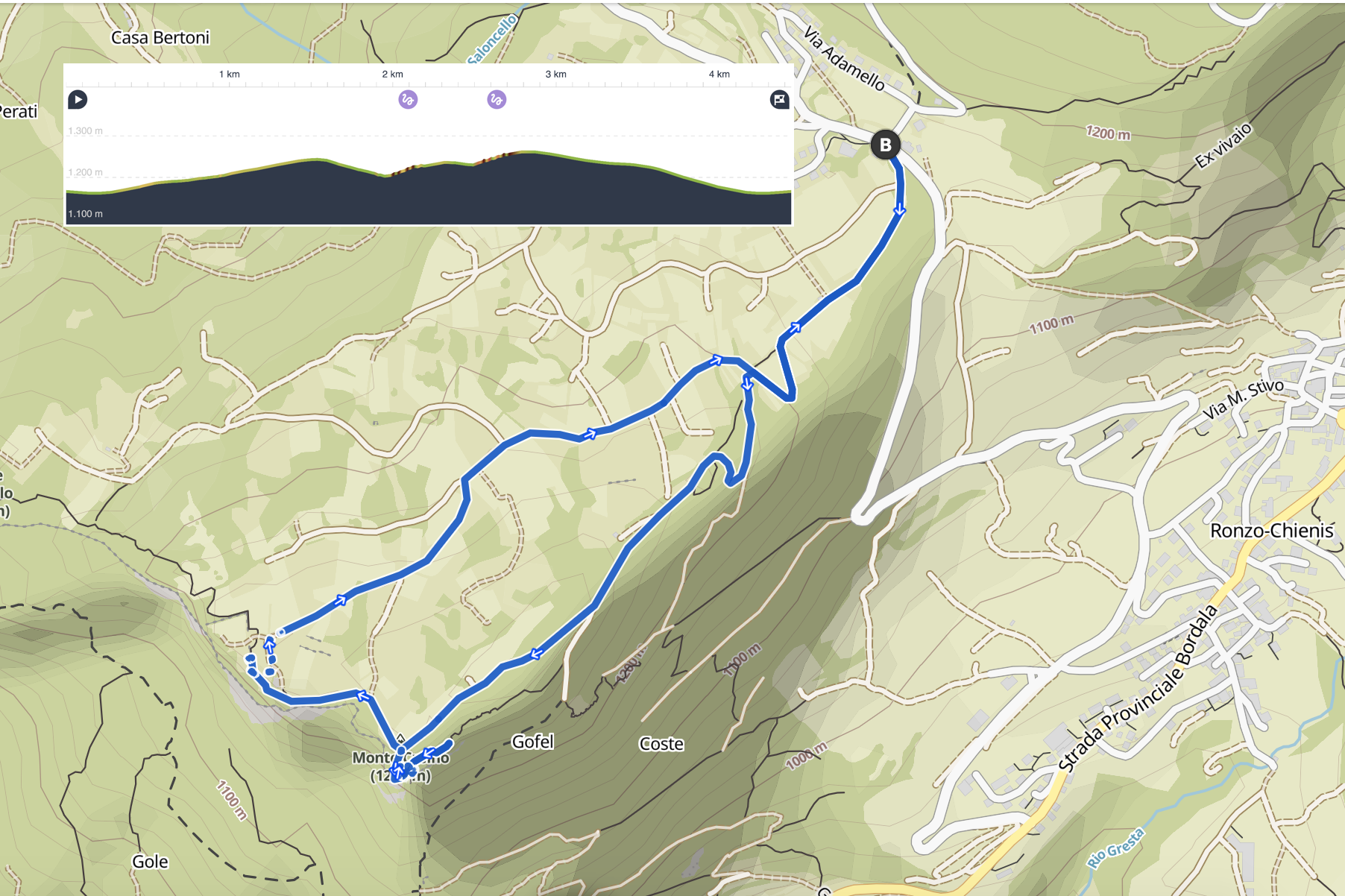
A flat path through the cultivated fields of Val di Gresta, at the end of the path you will find trenches, rock tunnels and posts built by the Austro-Hungarian army starting in 1914, some of which are still in excellent condition.
From the top you can enjoy a splendid view of Lake Garda.
ROUTE DESCRIPTION
The starting point is 8km from our hotel, you will find free parking there. The route begins in the immediate vicinity, follow the signs for Monte Creino.